 From Bergen to Greenland, straight across the open North Atlantic – with no magnetic compass, no sea chart, no GPS. How did a longship find its target when there was nothing but water and sky for days on end? The answer is less mysterious, and far more impressive, than the legends of a “magic crystal” suggest.
Let us start with a deflating fact that is also a compliment: the Vikings had no magnetic compass. The magnetic needle reached northern Europe only later, by way of China and the Mediterranean; during the Viking Age (roughly 793 to 1066) it simply was not available. And yet Norse seafarers regularly crossed the most dangerous sea route of their world – from Norway by way of the Faroes and Iceland to Greenland, and on to the coast of North America.
How? Not with a single miracle device, but with a whole bundle of experience, observation and orally transmitted knowledge. The steersman knew the flight paths of birds, the behaviour of whales, the colour of the water, the seasonal winds and – above all – the height of the sun above the horizon. For the Vikings, navigation was not a technical discipline but a craft, learned on board like sail-mending or a turn at the oar.
The backbone of open-sea voyaging was so-called latitude sailing. The idea is brilliantly simple: instead of calculating a course diagonally across open water, the navigator first sailed along the coast north or south until he sat on the same latitude as his destination. Then, with a favourable wind, he turned west (or east) and held that latitude as closely as he could – until land came into view.
Latitude was kept by watching the height of the midday sun above the horizon, or at night the height of the Pole Star. If the noon sun stayed at the same height, the course was good. If it climbed higher, he had drifted too far south; if it sank, too far north. It sounds crude, but in practice it worked remarkably well, because the key destinations – the Faroes, Iceland, Greenland – lay on clearly memorable latitudes.
That this method is no modern wishful thinking is shown by one of the finest sources on Norse seafaring: the sailing directions in the Landnámabók, the Icelandic “Book of Settlements”, preserved in the Hauksbók version. It describes the route from Norway to Greenland as a chain of bearings on known landmarks:
From Hernar in Norway one is to sail due west to Hvarf in Greenland; then you sail north of Hjaltland (Shetland), so that you just glimpse it in clear weather, then south of the Faroes, so that the sea reaches halfway up their mountain slopes, then south of Iceland, so that you have birds and whales from there.Landnámabók (Hauksbók), public-domain translation of the medieval text
This is no incantation but a sober set of instructions: hold due west, Shetland just on the horizon, the Faroes half in the water, keep Iceland to the south. Anyone who kept these visual bearings stayed on course – a whole system of landmarks, sighting heights and natural signs, packed into a few sentences.
By far the greater part of Viking voyaging was not open sea at all but coastal sailing. Along the rugged coasts of Scandinavia, the British Isles or the Baltic, one worked from landmark to landmark: a striking peak, a river mouth, a familiar island. Such reference points were held in memory and passed on by word of mouth – a pilot book that never needed writing down, because it lived in the heads of experienced steersmen.
Water depth was a tool too: with a sounding lead one tested the bottom, whose colour and texture told seasoned sailors where they were. And distances were reckoned in dœgr – half-days of a voyage – not in kilometres. A leg of so many dœgr was a solid quantity once you knew your ship, the wind and the route.
Where no landmark helped, nature did. Coast-bound birds signalled the nearness of land – a trick that echoes in the Landnámabók (“birds and whales from there”). A famous anecdote tells of the settler Hrafna-Flóki, who carried ravens on his voyage to Iceland and released them: the bird that did not return to the ship pointed the way to land.
To this were added countless further signs: the migration paths of whales, the pattern of the swell, the colour of water over shoals, driftwood and seaweed, even the shape of clouds banking up over unseen islands. An “ice-blink” or “land-blink” – the bright reflection of ice or land on the cloud base – could betray Greenland long before the coast itself was visible. None of it was an instrument; all of it was a trained eye.
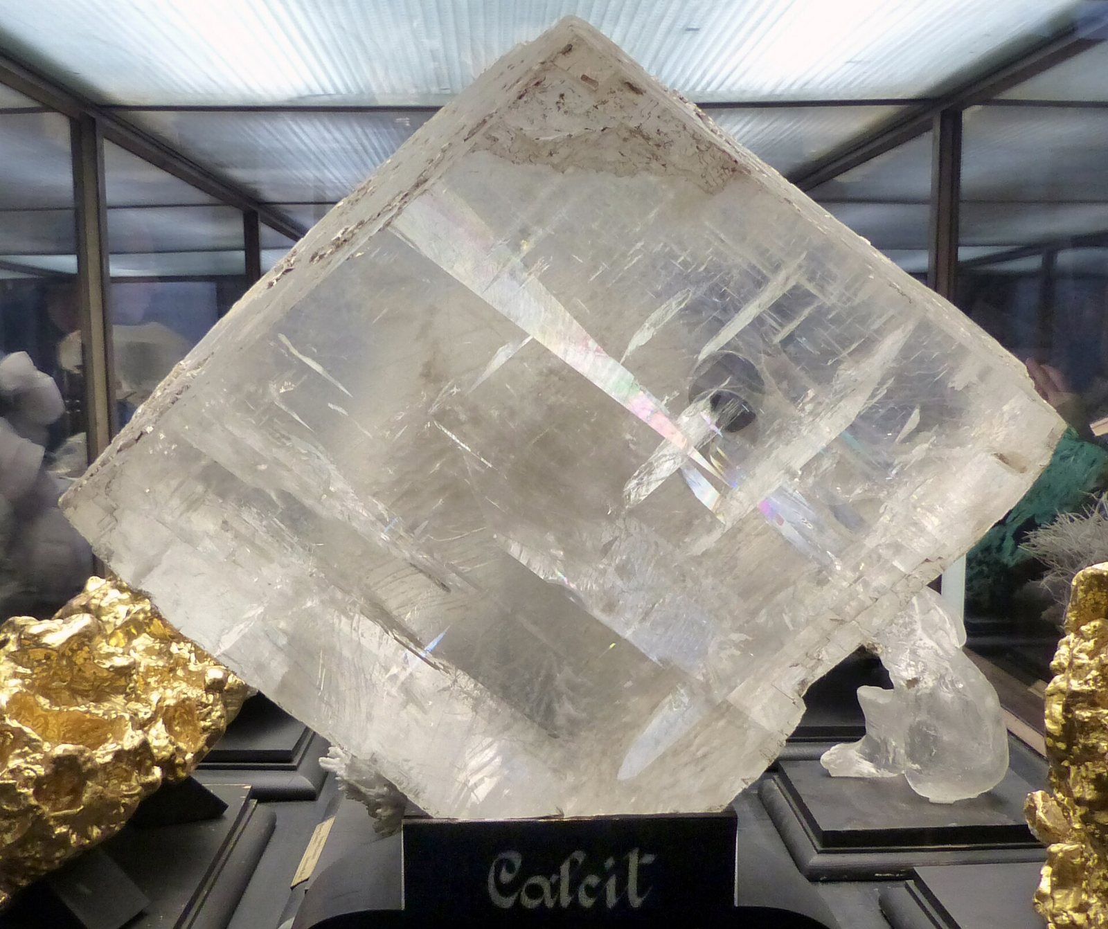
And now to the most famous piece of the puzzle: the sunstone. A handful of medieval Icelandic texts – such as Rauðúlfs þáttr – mention a sólarsteinn said to reveal the position of the sun under an overcast sky. The modern interpretation: a birefringent crystal such as calcite (Iceland spar) that makes the polarised light of the sky visible. Turned against the grey sky, the polarisation pattern lets you narrow down the direction of the hidden sun – and thus north.
Optical experiments (among them studies from the 2010s) show that this really does work physically and can be accurate to within a few degrees under cloud. Fascinating, so far. But: no sunstone from a securely Viking-Age ship find exists. The much-cited calcite crystal from the wreck off Alderney comes from an English ship that sank in 1592 – roughly five centuries after the Viking Age. At most it shows that crystals played a role aboard later ships, not that Vikings used them.
A second candidate for an “instrument” is the wooden disc from Uunartoq, found in the ruins of a Norse farmstead in Greenland and usually dated to the 11th century. The fragment bears notches around its rim and is interpreted by many scholars as part of a sun compass: a central pin casts a shadow whose tip traces a curve through the day; keep the shadow on the incised line and you keep your course.
A field test speaks for its practicality: in 1984 an expedition sailed a reconstruction of a Norse merchant ship between Iceland and Greenland and set replicas of the Uunartoq disc against a modern magnetic compass – the deviation was described as “negligible”. Even so, caution remains: only a small, weathered fragment survives, and whether it really was a shadow-bearing compass or, say, a decorative object is not conclusively proven. The interpretation is well-founded, but it remains an interpretation.
To sum up: the most impressive “technology” of the Vikings was not a device but a mind. Latitude sailing, visual bearings, the reading of birds, whales, water and clouds, bundled into orally transmitted sailing directions like the one in the Landnámabók – this carried the longships across the North Atlantic. Sunstone and sun disc are exciting, physically plausible additions, but archaeologically not firmly attested for the Viking Age.
Perhaps that is the finest point of all: what made the Vikings great seafarers was not one secret crystal but knowledge gathered, shared and remembered over centuries. A treasure you cannot dig up – only admire.
Historically secure are latitude sailing and visual bearings on landmarks (the Landnámabók/Hauksbók sailing directions), reckoning in dœgr, sounding with the lead, and the observation of birds, whales, water colour and clouds. The Uunartoq disc (11th c.) exists as a genuine find and is widely interpreted as a sun-compass fragment; a 1984 reconstruction field test was successful.
The Vikings had no magnetic compass – that came later from the east. The sunstone is physically plausible, but NOT archaeologically attested for the Viking Age: the well-known Alderney calcite comes from an English ship that sank in 1592, not from a longship. And the Uunartoq disc survives only as a small fragment – the sun-compass reading is well-founded, but not a final proof.

The longships · The Gokstad Ship · The Skuldelev ships · The Oseberg ship & the two women · Leif Erikson.
All Ships & Seafaring articles →
There is an Old Norse word for the quietest terror of seafaring: hafvilla, the “sea-bewilderment.” It does not mean the …
Read more →Some graves are so rich that they still take our breath away. The Oseberg grave near Tønsberg in Norway is one such: a …
Read more →Around the year 1070 the people of Roskilde deliberately sank several old ships in a narrow channel of their fjord – as …
Read more →