Not a single leader of the Gabali is known by name. No battle carries their name, no legend, no monument. And yet a landscape in the French Massif Central has been named after them for more than a thousand years: the Gévaudan. Between the people and the place name lie a Roman administrative reform, a town at a thousand metres above sea level, a bishop’s seat that wandered – and a silver mine that has only recently been properly understood. This is the story of how an ethnic name becomes an authority, and the authority becomes a map.
Everything ancient authors say about the Gabali fits on half a page. Caesar names them three times, all three in the seventh book of the Gallic War, and all three times without a single personal name. Strabo gives them two half-sentences. Pliny the Elder lists them among the peoples of Aquitania – and, surprisingly, in a chapter about cheese. Ptolemy records them as Tabaloi. After that the literature falls silent until the name resurfaces in late antique administrative lists, no longer as a people but as a district.
That is not unusual. It is how the record looks for the great majority of Gallic peoples. The difference is that most of those names then vanished, while this one has held on for two millennia. Why this one is the interesting question.
The territory of the Gabali corresponds broadly to the modern Lozère, the most thinly populated department in France. It is highland country made of three very different parts: the wide basalt plateau of the Aubrac in the north-west, the granite Margeride in the north, and in the south the limestone Causses and Mont Lozère, which rises above 1,600 metres. Between them the Lot, the Tarn and the Truyère cut deep gorges.
People here lived on livestock, timber and whatever the mountain held. Large-scale arable farming is not an option at that altitude. Those three things – herds, wood and ore – are precisely what the ancient notices about the Gabali mention. To the north lay the Arverni, to the north-east the Vellavii, to the south and west the Ruteni, and to the east, beyond the watershed, the Helvii.
The Latin form Gabali goes back to a Gaulish *Gabloi. The stem gablo- denotes first the forked branch of a tree, then a fork more generally. Related to it is a Gallo-Latin *gabalottus meaning a throwing spear, which probably gave French javelot. That is the etymology in Delamarre and in Matasović, and as far as it goes it is sound.
What it is not is an explanation. Why anyone would name a people after a fork, nobody knows. The obvious readings – spearmen, people of the fork between two rivers – are guesses, not evidence. With Gaulish ethnic names, certainty routinely stops at the root; everything beyond it is interpretation.
The Gabali first act in the spring of 52 BC, and even then they do not act on their own initiative. Vercingetorix sends the Cadurcan Lucterius south to win over the peoples along the edge of the Roman province. Lucterius goes first to the Ruteni, then on to the Nitiobroges and the Gabali, takes hostages from both and assembles a force large enough to threaten the Narbonensis (Gallic War VII,7).
Giving hostages means you are not joining an alliance as an equal partner. And the man who takes them belongs to the Cadurci, the neighbouring people to the south-west. The Gabali therefore enter recorded history as people whose entry into a war was decided by others.
Shortly afterwards comes the one passage in which the Gabali do something attributed to them alone. Vercingetorix divides the fronts: the Aedui and Segusiavi against the Allobroges, the Ruteni and Cadurci against the Volcae Arecomici – and the Gabali, together with the nearest Arvernian districts, against the Helvii (Gallic War VII,64).
The attack succeeds. The Helvii give battle, lose, and among the fallen is Gaius Valerius Donnotaurus, the leading man of their people. The survivors withdraw behind their walls. For a brief moment the Gabali are a military factor – and even in that moment Caesar names them in the same breath as Arvernian districts. There is no escaping this clientage, not even in victory.
By summer Vercingetorix is trapped at Alesia. The Gallic council decides to raise the relief army not by a general levy but by fixed contingents. Caesar lists them, people by people. In that list the Gabali appear for the last time.
Parem numerum Arvernis adiunctis Eleutetis, Cadurcis, Gabalis, Vellaviis, qui sub imperio Arvernorum esse consuerunt. – The same number from the Arverni together with the attached Eleuteti, Cadurci, Gabali and Vellavii, who are accustomed to be under the command of the Arverni.Caesar, Gallic War VII,75; translation: Glanz & Gravur (original text in the public domain)
The figure given – 35,000 men – is not a Gabalian figure. It covers the Arverni and their four attached peoples together. How many highlanders actually marched is nowhere stated. The manuscripts vary between Vellaviis and Velaunis for the neighbouring people; on the Gabali they agree.
The subordinate clause carries the real information: qui sub imperio Arvernorum esse consuerunt. Caesar does not say the Gabali were subjects or a province of the Arverni. He says they were accustomed to stand under Arvernian command. That is the language of Gallic clientage: an asymmetrical alliance in which a strong people expects military support and offers protection, arbitration and access to trade routes in return.
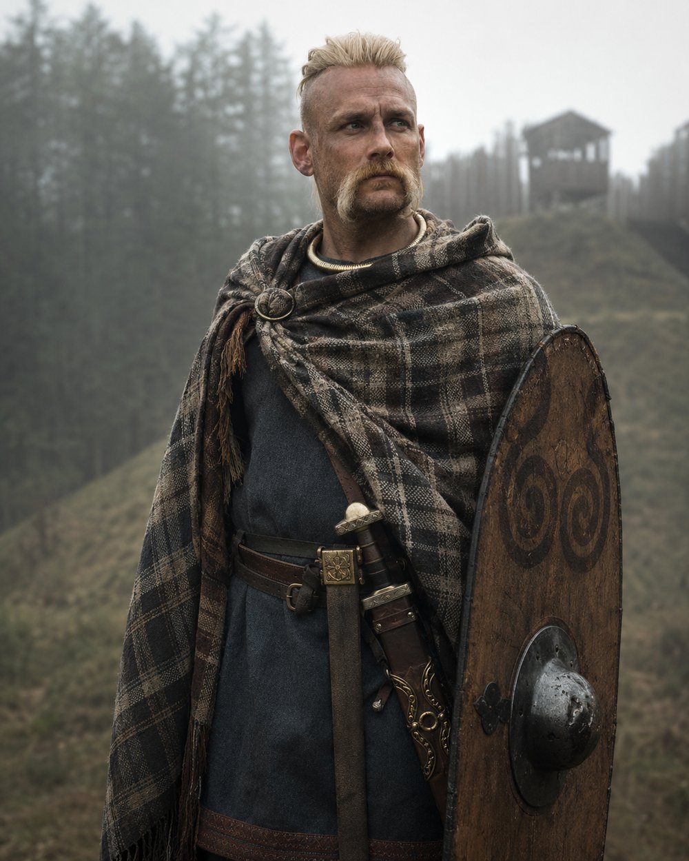
How close the bond was in any given case cannot be measured. Scholars generally judge the tie of the Gabali and Cadurci to the Arverni to have been tighter than that of the Vellavii – but that is an inference from the overall picture, not a statement in the sources. Of Gabalian equipment, tactics or retinue customs we know nothing at all; what one reads on the subject is drawn from the general picture of Celtic warriors.
The second ancient witness is brief and important. Strabo lists the peoples between the Garonne and the Loire that were administratively assigned to Aquitania and notes their products: fine ironworks among the Petrocorii and the Bituriges Cubi, linen among the Cadurci, silver mines among the Ruteni – and the Gabali, he adds, also have silver mines (Geography IV,2,2).
This claim is often repeated, and in such cases suspicion is healthy. Here it survives scrutiny: the sentence stands in the text, it has not slipped across from the neighbouring notice about the Ruteni, and Strabo names Ruteni and Gabali explicitly one after the other. In the same passage, incidentally, he records that Rome granted Latin right to certain Aquitanian communities – he names the Ausci and the Convenae, not the Gabali.
For a long time Strabo’s half-sentence stood alone. That has changed. Mont Lozère holds silver-bearing galena, and a French research programme has systematically recorded the old workings, slag heaps and charcoal-burning platforms – over 75 slag sites and more than 200 associated charcoal pits. The main phase falls in the high Middle Ages, in the eleventh and twelfth centuries.
The second, unexpected result matters more here. At Le Devois near Ispagnac an open-cast working was excavated in 2011 and 2012, following a quartz vein of argentiferous lead in narrow parallel trenches. The earliest radiocarbon dates reach back to the late second century BC – that is, to a period when the territory was still independently Gabalian, well before Caesar. Geochemical lead signals in peat profiles point to the same pre-Roman metallurgical phase. So Strabo, for once, is demonstrably right. What he does not say is the scale: a few trenches on a slope do not make a mining district, and every tonnage figure one reads is an extrapolation.
The decisive change happens between Caesar and Strabo, and it happens without a battle. The Arvernian appendage becomes a civitas Gabalorum in its own right. Scholars usually date the step to the reign of Augustus, most likely to the last two decades of the first century BC.
The intention is easy to read. A people that in 52 BC could field a contingent of 35,000 men together with four clients must never be able to do so again. So the clients are detached and made into administrative units of their own – the Gabali along with their neighbours, whose path we have traced elsewhere (the Vellavii). What looks like promotion is in fact the weakening of the neighbour. And it is precisely this administrative act that makes the Gabalian name durable: a people can die out, but a district stays in the lists.
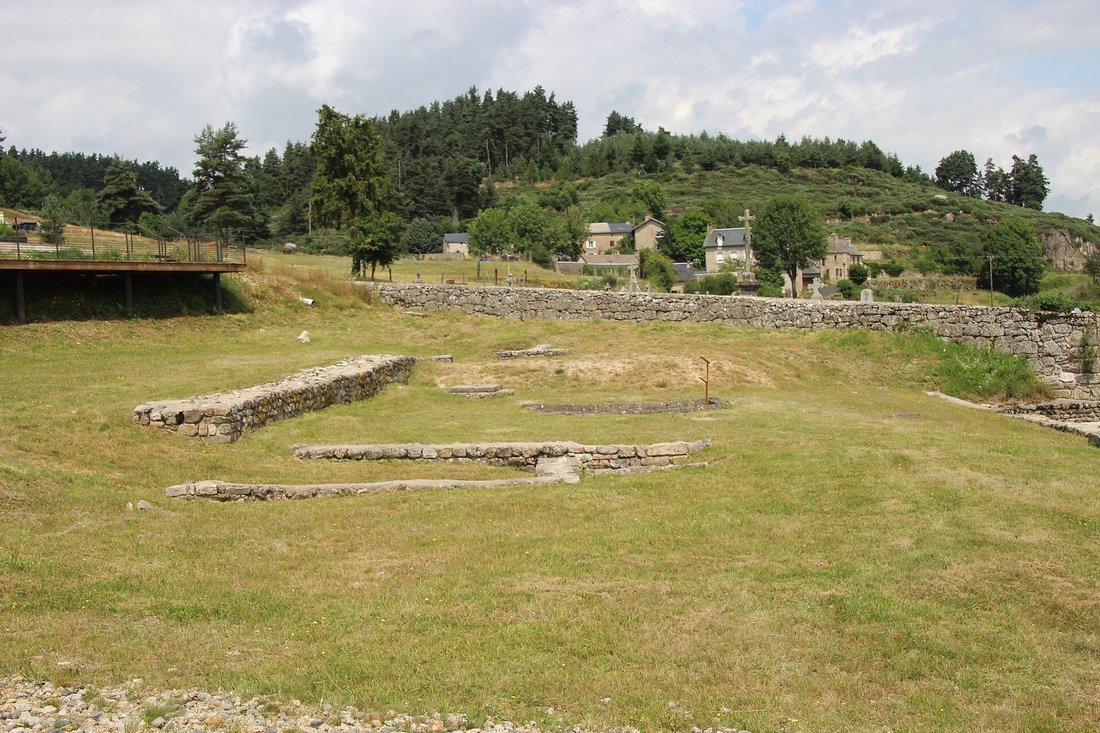
The new civitas needed a capital, and it got one that had never been a capital before. Anderitum, modern Javols, lies in the widened valley of the Triboulin at between 972 and 1,015 metres. The name is Gaulish, from ande- and rito-, roughly “in front of the ford” or “great ford”. There was no substantial oppidum there; late La Tène settlement consisted of scattered sites on the surrounding heights. The only candidate for a pre-Roman central place is Saint-Bonnet-de-Chirac, some twenty kilometres away.
In the second century the town reached its greatest extent: roughly 35 to 40 hectares, of which barely 6 were densely built and laid out on an orthogonal grid, with a population of a few thousand. It had a forum of about 70 by 50 metres, a basilica of some 50 by 23 metres, two public bath buildings, three recoverable town houses and an entertainment building against the hillside whose largest dimension does not exceed 80 metres – whether amphitheatre or theatre remains unresolved. The stream was channelled to a width of eleven metres between granite blocks joined with iron clamps sealed in lead.
That Javols is Anderitum at all was disputed in the nineteenth century. In the 1820s Charles Athanase Walckenaer placed the town at Anterrieux in the Cantal. The matter was settled in 1828, and by accident: while villagers were searching for building stone to repair the church, a milestone came to light, set up under the emperor Postumus and dedicated by the civitas Gabalum (CIL XIII 8883).
A dedication signed collectively by a whole community belongs in that community’s capital. The debate ended there. The stone now stands in the middle of the arena of the entertainment building – a milestone turned into evidence, which put a town back on the map.
Economically the civitas lived on what the highland provided. The woods supplied fuel for pottery kilns and timber for coopering and building; the uplands carried herds. And then there is a passage in Pliny that is easy to overlook: in his chapter on cheeses he names as the most highly regarded at Rome those from the territory of Nemausus, and above all from the districts of Lesura and the Gabalicus pagus – though they keep only briefly and must be eaten fresh (Natural History XI,240 f.).
That is the earliest attestation of the regional name anywhere, and it appears in a chapter about food. A highland people at the edge of the world supplied the capital with a delicacy. As for pottery: the terra sigillata workshops of Banassac, on Gabalian ground beside the Urugne, were probably founded by potters from La Graufesenque and worked, on recent dating, from about AD 90/120 into the second half of the second century.
For an engraving workshop, Banassac is the most interesting site in this whole story. Because there people did not only stamp – they incised, by hand, into clay that was already hard but not yet fired, in Latin cursive script but in the Gaulish language. Ten such graffiti are known; six come from a single excavated area.
The most famous runs around the outside of a bowl a good ten centimetres across: neddamon delgu linda – “I hold the drink of those who come next”. Another opens with the imperative lubi, “value it, love it”. A third contains the word celicnu, known from a dedication at Alesia where it denotes a hall for communal use. From this Emmanuel Dupraz argued in 2023 that these pieces were not merchandise at all but drinking vessels for the potters’ own meeting hall. The goods made for sale carried Latin formulas in capitals instead, such as VENI AD ME AMICA. Two languages, two purposes, one workshop. The readings of the Gaulish texts are partly uncertain – only two of the six can be translated as continuous sentences at all.
Towards the end of the third century something happens that is otherwise known from much larger cities: the town loses its own name and is called after its people. Anderitum becomes ad Gabalos, the town of the Gabali. The same pattern appears at Tours, Le Mans, Beauvais, Limoges and Périgueux, where ancient place names were replaced by tribal names.
At the same time the town contracts. Outlying quarters are abandoned, the upper parts of the entertainment building are destroyed or repurposed, construction collapses. No late antique town wall is ever built here, unlike at other civitas capitals. But Anderitum does not die suddenly: traces of urban activity continue into the fifth century, after which settlement shifts to the margins of the valley.
The Christian tradition of the Gévaudan hangs on a single name. Gregory of Tours tells of Privatus, whom he calls episcopus urbis Gabalitanae, bishop of the city of the Gabali: while a Germanic incursion ravages the country the population takes refuge in the hill fort of Grèzes, and Privatus fasts in a cave on Mont Mimat. He is found, used as leverage, refuses to hand over his people and dies of his injuries. Venantius Fortunatus later lists him alongside Julian of Brioude and Ferreolus of Vienne.
Soberly considered, almost every detail is contested: the century of the martyrdom, the identity of the attackers, even the episcopal title – in 314 a certain Genialis represented the Gévaudan at the Council of Arles as a deacon, not a bishop. In the late antique provincial list of the Notitia Galliarum the district then appears as civitas Gabalum in Aquitania Prima. When the see moved from Javols to Mende is an open question: the mid-sixth century has been proposed, possibly with an interim stage at Banassac, but the first firm evidence is a bishop Stephanus signing as bishop of Mende in the tenth century.
That completes the path, and it has four stages. A tribal name becomes a clientage entry in Caesar. Augustus turns the clientage into a civitas. In late antiquity the civitas becomes a bishopric, and the district name outlives the collapse of its capital. Gabalicus pagus becomes Gavuldanum in the tenth century, Gavalda in the thirteenth – and finally Gévaudan.
The people themselves vanished without trace along the way. Nobody in the medieval Gévaudan would have called himself a Gabalian, and nobody still spoke the language in which someone once scratched neddamon delgu linda into a bowl. What survived is the sound of a word that may originally have meant a fork. Anyone driving through the Lozère today reads a piece of administrative history on every second road sign – a piece more than two thousand years old.
Caesar names the Gabali three times (Gallic War VII,7; VII,64; VII,75), always without personal names. Strabo (Geography IV,2,2) explicitly credits them with silver mines – the passage is genuine and not a confusion with the Ruteni. Pliny lists the cheese of the Gabalicus pagus among those most prized at Rome (Natural History XI,240 f.); Ptolemy records them as Tabaloi (II,7,11). The milestone CIL XIII 8883, dedicated by the civitas Gabalum, secures Javols as the capital. The Notitia Galliarum lists the civitas Gabalum in Aquitania Prima. Archaeologically established are the town of Anderitum with its forum, basilica, two bath buildings and entertainment building; the sigillata production at Banassac with ten Gaulish incised inscriptions; and pre-Roman silver-lead mining on Mont Lozère with radiocarbon dates from the late second century BC onwards.
The Beast of the Gévaudan has nothing to do with the Gabali. The series of attacks falls in the years 1764 to 1767 – some eighteen centuries after Caesar. Depending on the count, between 88 and 230 dead and wounded are attributed to it; in September 1765 the royal gun-bearer François Antoine shot a large wolf, and on 19 June 1767 the farmer Jean Chastel killed a second animal, after which the fatal attacks stop. The only link between the two subjects is the name of the landscape. Second: Caesar’s 35,000 men are advocacy, and they cover the Arverni together with four client peoples – no Gabalian troop figure exists. Third, the story that Alamanni under a certain Chrocus destroyed Gabalum in the third century is persistent but comes from hagiography and nineteenth-century local history. The excavations at Javols show fires, but no destruction horizon that can be tied to an invasion – only a slow contraction spread over two centuries.
The Arverni · The Vellavi · The Ruteni · The Cadurci · The Helvii · The Convenae · The Celtic Warriors.
All History & Finds articles →
Two horns of heavy gold, covered all over with puzzling figures, and on one of them a line of runes in which, for the …
Read more →