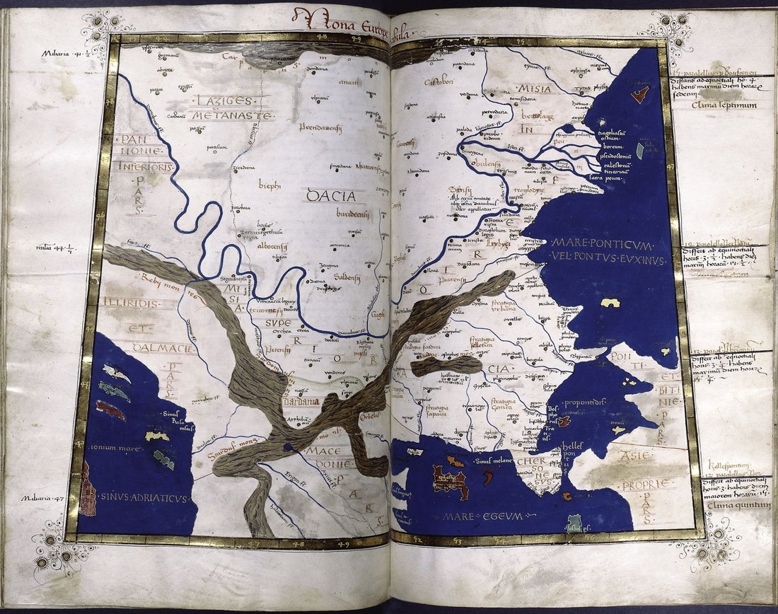
Some peoples enter world literature because somebody was trying to describe something else. The Anartes are one of those cases. Caesar mentions them exactly once, and not because they interested him, but because he had to explain how far the Hercynian Forest extended: the forest, he says, reaches as far as the borders of the Daci and the Anartes. An entire people used as a measuring stick. From there arises the question this article is really about: how far east did the Celtic world reach, and how would we even recognise it – by names, by finds, or only by both together? For that question the Anartes are a gift, because in their case the written source and the excavated evidence sit so far apart that you can watch the problem at work.
Most ancient peoples appear in the sources because they did something: they fight, they negotiate, they pay tribute, they are subdued. The Anartes appear because a forest has to stop somewhere. In the sixth book of the Gallic War Caesar describes the Hercynian Forest – that vast, half geographical and half mythical woodland which for Romans meant everything north and east of the Danube – and he describes it the way you describe things without a map: through neighbours and through days of travel.
Nine days for a man travelling light to cross its width, he writes, adding drily that it cannot be stated otherwise, since the people there have no measures for distances. Sixty days' march, and nobody has yet reached its beginning. It is inside this frame that the name we are after appears.
It is worth pausing on that construction. We know of the Anartes because a Roman commander wanted to measure a forest he had never seen, using information he had almost certainly received at second hand. Everything else ever said about them hangs on that one subordinate clause and on a handful of later lines.
The sentence stands in Bellum Gallicum VI,25. This matters, because the scholarly literature occasionally wobbles here: the Hercynian excursus opens in VI,24 with the remark that Eratosthenes had already heard of this forest, and some studies cite the whole section loosely as VI,24. The Anartes themselves, however, belong unambiguously to the following chapter.
Oritur ab Helvetiorum et Nemetum et Rauracorum finibus rectaque fluminis Danubi regione pertinet ad fines Dacorum et Anartium; hinc se flectit sinistrorsus diversis ab flumine regionibus multarumque gentium fines propter magnitudinem adtingit.
Caesar, Bellum Gallicum VI,25; own translation
It begins at the territory of the Helvetii, the Nemetes and the Rauraci, runs in a straight line along the course of the Danube, and reaches as far as the borders of the Daci and the Anartes; from there it turns to the left, into regions away from the river, and because of its size it touches the territories of many peoples.
The forest begins with the Helvetii and it ends with Daci and Anartes. Between those two ends lies the whole of central Europe that Rome did not control at the time. In this sentence the Anartes simply mark the eastern edge of the known world.
Caesar does not say that the Anartes are Celts. He does not say how they live, how they fight, whom they worship, how many they are, whether they have a king. He does not even say precisely where they sit – only that the forest reaches their borders and that they are named alongside the Daci.
That is still not nothing. Two things can be cautiously drawn from the phrasing. First, Caesar distinguishes Anartes from Daci. He names them side by side, not one as part of the other. This is the main reason scholarship treats them as a separate entity at all. Second, they must be neighbours, otherwise the double naming as a boundary would make no sense.
Everything else – Celtic or Dacian, tribe or confederation, large or small – is not in the text. It is the product of inferences drawn centuries later, and it pays not to confuse the inference with the source.
Anyone leafing through the literature trips over a small irritation: the people are called Anartes, Anarti or Anartii, apparently at random. This is not a dispute about substance but a consequence of how the name is transmitted. Caesar gives it only in the genitive plural, Anartium. He nowhere supplies a nominative.
From Anartium one can reconstruct either Anartes or Anarti, and both reconstructions have their supporters. Two centuries later Ptolemy writes in Greek Anartoi, corrupted in later manuscripts to Enartoi, which rather favours the second option. The Latin inscriptions of the imperial period likewise use forms consistent with Anarti.
One may call this pedantry. It is in fact a neat little object lesson: even the basic form of this people's name is already a modern reconstruction. We know it only as others happened to decline it.
The second major witness is the Geography of Claudius Ptolemy, compiled in the second century AD. In his description of Dacia, Geography III,8,3, he lists the peoples of the province beginning in the north. There, side by side, stand Anartoi, Teuriskoi and Koistobokoi – Anartes, Teurisci and Costoboci.
The company is instructive. The name of the Teurisci echoes that of the Taurisci of the eastern Alps, and the Costoboci are well known from the Marcomannic Wars. Because the Costoboci are a second-century phenomenon, it has been argued that Ptolemy was here drawing on a contemporary source rather than merely copying old lists.
That is not certain. Ptolemy is a compiler who forces information of very different ages into a single coordinate grid. His chains of peoples look tidier than reality was, and he described regions well known to the Greeks with demonstrable errors. Anyone reading him for the barbarian interior of the Carpathian arc should keep that in mind.
Here is where it becomes genuinely interesting. In an entirely different part of the same work, in the description of European Sarmatia, Geography III,5,8, Ptolemy lists smaller peoples north of the Carpathians. Among them appears a name that makes one sit up: Anartophraktoi, slotted in between the Ombrones and the Burgiones.
Scholars have argued about its meaning since the nineteenth century. One line sees a splinter group of the Anartes that crossed the Carpathians northwards – into the upper Dniester basin or, in a more recent Polish variant, onto the upper San. The other line holds the name to be simply a doublet: the same people listed twice because Ptolemy drew on two sources and failed to notice. This reading is neither new nor marginal; it runs from Šafárik in 1842 through Kętrzyński in 1901 to Sorin Nemeti in 2014.
One detail is easily overlooked and decides a great deal: Ptolemy names Anartes and Anartophracti in different books and says not a word about whether or how they are connected. The entire link is a modern achievement.
The sharpest objection to the romantic reading of a Celtic migration across the Carpathians comes from linguistic observation. Ptolemy writes Greek. But the second element of Anartophraktoi, fracti in the sense of broken off or detached, is a Latin word. The name is a Greek-Latin hybrid.
A solid date follows from this. Such a mixed form does not arise inside a Greek tradition but where Roman informants and Latin sources are involved. Roman interest in Dacia, however, begins only in the second half of the first century BC, when Burebista reshaped the Danube lands. The name Anartophracti can therefore be no older than that.
This demolishes a popular chain of reasoning. Anyone equating the Anartophracti with Celtic settlements of the third or second century BC must assume that Ptolemy was passing on an ancient report. The form of the name rules precisely that out.
For a people this thinly attested, the list of authors who do not mention them is almost as telling as the list of those who do. Neither Strabo nor Pliny the Elder names the Anartes. Nor does Tacitus, who in the Germania has the peoples of the Carpathian foreland very much in view and treats the Cotini and the Osi there at some length.
This is not an accident of transmission but an indication of scale. We are not dealing with a power that caused Rome concern, but with a regional entity at the edge of the field of vision. They share that marginal position with other Carpathian peoples, for instance the Marsigni, who appear in Tacitus exactly once in a list and never again.
Anyone writing about ancient peoples has to keep this asymmetry in mind. Visibility in the sources measures Roman attention, not local importance.
And then something unexpected happens. One would assume the trail goes cold after Ptolemy. The opposite is true: Latin inscriptions name them, and they run from the end of the first century BC into the 240s AD.
The earliest is the so-called Elogium of Tusculum, dated to roughly 19–10 BC. The fragmentary text praises a governor of Illyricum who crossed the Danube; of his name barely an ending survives, usually restored as Marcus Vinicius. The peoples listed there are Anartes, Bastarnae and Daci, together with Cotini and Osi. Then follow a tombstone from Aquincum, a milestone from Transylvania dated 236, and an altar from Budaörs in Hungary dated 247–249 which names a vicus Anartorum.
Not all readings are secure. On the milestone from Almașu Mare the decisive word is damaged; Ioan Piso and Dan Deac propose a quite different restoration instead of vico An[artorum]. The Budaörs altar, by contrast, is regarded as unambiguous.
Among all these testimonies one is of a different order. A tombstone from Aquincum, the Roman predecessor of Budapest, names a woman: Iulia Utta Florina, daughter of Eppo, an Anartian by birth, who died at the age of eighty-five. She is the only individual from this people whose name has come down to us.
The stone tells an entire biography in three words. Eppo and Utta are regarded as Celtic names – they are one of the principal arguments for treating the Anartes as Celts at all. Iulia, by contrast, is Roman. Within a single generation the whole road runs from an ethnic label to a Roman citizen's name. Even so, one should not build too much on it: one person attests one person, not a community.
That applies all the more to the vicus Anartorum. In Roman usage vicus denotes a rural settlement, a village; for a larger administrative unit one would have said civitas. A village of the Anartes is therefore exactly that: a village inhabited by people who were called that. The geography is the remarkable part. None of the inscriptions comes from northern Dacia, where the Anartes are usually placed; they come from Pannonia and from the interior of Transylvania. The obvious explanation is resettled or migrant groups who carried their name of origin with them, as happened regularly in Roman frontier policy.
That inverts the picture. The Anartes do not vanish after Ptolemy. On the contrary, only in Roman times do they become tangible with a name and a place – just not where Caesar led us to expect them, and no longer as an independent entity but as a population group inside the empire.
The question of their territory has a fine punchline. The Barrington Atlas, the standard cartographic work for the ancient world, assigns the Anartes no territory at all. They are left unlocated.
The proposals in the literature diverge accordingly. Ioana Bogdan-Cătăniciu rejected an older placement around Satu Mare and took the Criș as the southern limit. Gábor Vékony put them between the Mureș and the Someș. Venceslas Kruta located them in the uplands north-east of the Danube, on the modern Slovak-Hungarian border. Marek Olędzki argued for the upper Tisza basin.
The outcome of this debate is modest but honest: the people can be assigned broadly to the space between north-western Romania, eastern Slovakia and adjacent Hungary, and the tradition supports nothing sharper. Every firmer boundary on a modern map is drawn, not transmitted.
Archaeologically the upper Tisza region is anything but empty. On the contrary, it is one of the most interesting contact zones of the late La Tène period. Two sites stand for it.
Zemplín in eastern Slovakia developed from an open settlement into a fortified complex of the so-called Zemplín type and further into a place with Roman-period buildings. Its material is mixed Celtic and Dacian, and the associated cemetery is among the region's most important sources. Galish-Lovachka near Mukachevo in Transcarpathian Ukraine, in turn, was an extensive settlement with strikingly heavy ironworking: some two dozen sunken dwellings yielded around a thousand objects, among them swords, curved knives, spearheads, chain belts and more than thirty Celtic coins on Macedonian models.
These sites show what the written sources withhold: highly specialised craft, supra-regional contacts, a population that used Celtic forms while absorbing Dacian ones. The one thing they do not show is what these people called themselves.
This is the methodological heart of the matter. In many popular accounts the equation runs: Caesar and Ptolemy place the Anartes in the upper Tisza region, the upper Tisza region contains Celtic-influenced settlements, therefore these are Anartian settlements. The inference is convenient and, as proof, wrong.
It links two things that need have no connection: a material culture and a name. Archaeological cultures are distribution patterns of forms and techniques. They follow trade routes, workshop traditions and fashions. Ethnic self-designations follow kinship, politics and narrative. The two sometimes coincide, but not as a matter of law – Sebastian Brather has questioned the ethnic interpretation of archaeological cultures on principle, and for good reasons.
It is telling how the specialist literature phrases things itself. When the abandonment of Galish-Lovachka at the transition to the late La Tène period is discussed, the text speaks of a conflict between local Celts and outsiders – and behind the word Celts stands a question mark in brackets. That bracket is the most honest part of the sentence.
A widespread short circuit concerns the Púchov culture. It is occasionally attributed to the Anartes, occasionally to both peoples jointly. The evidence argues otherwise: its core area lies in northern and central Slovakia, in the Váh valley and in Liptov and Orava, and the classic attribution is to the Cotini, whom Tacitus knows in the Carpathian foreland and whose iron production he specifically mentions.
Zemplín, by contrast, lies far to the east of Slovakia, several hundred kilometres away and in a different find environment. Throwing both regions into a single attribution blurs exactly the distinctions that matter.
And the Cotini attribution is itself an interpretation, not a document. It is merely better founded than the alternative. In this field that already counts for a good deal.
Around the middle of the first century BC everything in the Carpathian basin changes. The Dacian king Burebista pushes west. Strabo reports in Geography VII,3,11 that he laid waste the Celts who were intermingled with Thracians and Illyrians and brought about the complete disappearance of the Boii under Critasirus, together with the Taurisci.
The Anartes do not appear in this report. That is worth saying plainly, because survey accounts frequently state that Burebista subdued the Celts of the Carpathian basin, whereupon the Anartes get silently counted in. The only peoples named are Boii and Taurisci.
One may suspect that a people on the north-western edge of Dacia was affected by this shift of power. Suspect, however, is the correct word. And it fits an observation that runs through the whole tradition: the Anartes always stand beside the Daci, never against them.
How open the question remains is best shown by setting two current positions side by side; they could hardly be further apart.
Alexander Falileyev identifies the Anartes with the La Tène population that becomes visible in the upper Tisza region from about 340–320 BC and disappears from the archaeological record around 170 BC. Finding no sign that they were absorbed locally, he reads the disappearance as a migration – possibly eastwards, where Celtic-speaking groups turn up on the Dniester in the third century and Celtic bands threaten the Greek colony of Olbia.
Tomasz Bochnak reaches the exact opposite conclusion. For him there is no basis whatever for linking the Anartes with the La Tène horizons of the third or second century. All the written evidence falls between the middle of the first century BC and the 240s AD. To place them earlier is to project backwards. Both scholars read the same sources. They arrive at peoples four hundred years apart.
That leaves the question of affiliation. In favour of Celtic there is above all the name, which many have regarded as Celtic since Wilhelm Tomaschek; Alexander Falileyev considers either a suffixal derivation or a compound with Gaulish artos, the word for bear. To this are added the Celtic personal names Eppo and Utta on the stone from Aquincum, and Caesar's separation of them from the Daci.
Against it stands the caution of the name specialists. Patrick Sims-Williams regards the Celtic attribution of the name as uncertain; occasionally it has been read as Iranian or as Dacian. And even if it is Celtic, little follows: an ethnic name can be borrowed from a neighbouring language, and it can be a name given from outside.
The most defensible formulation today therefore runs roughly as follows: a group of Celtic tradition that came under increasing Dacian influence in the first century BC and whose descendants inside the empire were Romanised. That is less quotable than a label, but it survives contact with the evidence. Anyone wanting to know more about the world behind it will find it in the material culture rather than in the names of peoples anyway.
This finally allows the opening question to be answered, though differently than expected. The Anartes are not the easternmost Celtic name of antiquity. That distinction belongs to the Galatians of Asia Minor, roughly a thousand kilometres further east. The Anartes mark something else, and something more precise: the eastern end of that continuous central European zone which a Roman observer could measure in a single sweep.
From the upper Rhine to the upper Tisza – that is the span Caesar's sentence opens up. At its western end stand Helvetii, Nemetes and Rauraci, at its eastern end Anartes and Daci. Everything in between was, for Rome, one enormous forest with many peoples inside it. The Galatians, by contrast, are a distant product of migration, no longer a neighbour.
And the answer to how we recognise it is: by both, and never by one alone. The names tell us that the ancients saw a boundary here. The finds tell us that in this space Celtic technique, Dacian pottery and Roman coin lay side by side. Together they yield not a people with borders but a zone in which languages, workshops and loyalties overlapped.
Perhaps that is where the Anartes have the advantage over us. We like to draw sharp lines across old landscapes. Caesar, who knew no better, was the more honest: nine days wide, sixty days deep, and at the far end live people whose name he knows and nothing else.
The Boii · The Taurisci · The Scordisci · The Galatians · The Cotini & Osi · The Marsigni · The Celtic Warriors.
All History & Finds articles →
He is called the "Apostle of the North" – yet when Ansgar died in 865, the North was still firmly pagan. The monk from …
Read more →