Around 800, people on a bay in Vestfold marked out narrow plots, each just big enough for one house. Some 130 years later the place had largely gone quiet, and a few decades after that the last trade and craft stopped too. No saga writer tells this story. It survives in a single remark by a Norseman at the court of Alfred of Wessex, in about 200 opened graves, and in layers whose youngest levels the plough has destroyed. This article looks at what the excavations of Charlotte Blindheim and Dagfinn Skre actually show about Kaupang, where the figures you see everywhere come from, and why nobody can say for certain why the town was abandoned.
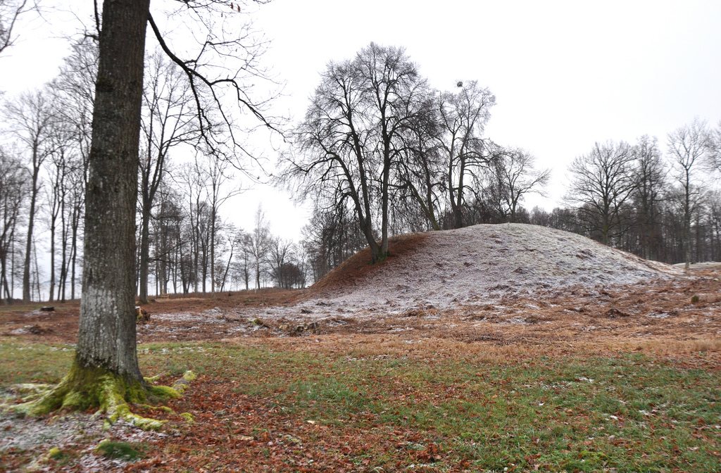
Kaupang lies on the Viksfjord, a branch of the Larviksfjord, in the modern municipality of Larvik. Today there are fields, woods and water, with no walls to see. That Norway's earliest town lay here can be shown only with spades, metal detectors and laboratory results.
That shapes this article. Our overview of Vestfold sets Kaupang among the ship burials and rulers of the region, and the piece on Viking trade places it in the network of emporia, the great transshipment sites. Here the subject is the proof itself: which statement about Kaupang rests on what, and where specialists part company?
Even the name comes with a caveat. Kaupang is a farm name, explained from Old Norse kaup ("trade, purchase") and angr ("bay, narrow fjord"). It describes a function. What people in the ninth century called their town we do not know. The only name from that period is a different one, and it comes from England.
Around 890, Ohthere (Ottar), a wealthy farmer from Hålogaland, told King Alfred about his voyages. The account was inserted into the Old English version of Orosius's world history; the surviving manuscripts date from the tenth and eleventh centuries. How he lived and what he did in the north is covered in our article on Ohthere of Hålogaland. For Kaupang, only a few lines matter.
"Then there is a trading place in the southern part of the land, which is called Sciringes heal. […] And from Sciringes heal, he said, he sailed in five days to the port called æt Hæþum, which stands between the Wends, the Saxons and the Angles and belongs to the Danes."Ohthere's account in the Old English Orosius, from the text in Bright's Anglo-Saxon Reader (Wikisource), my own translation; the route description is omitted
Old English port means a trading place. Heal means a hall. So Ohthere or his scribe names the harbour after a building, which will matter later. He adds two travel times: more than a month from Hålogaland if you camp at night and have a fair wind every day, then five days on to Hedeby, with Denmark to port. "Fair wind" is the usual reading of Old English ambyrne wind, as in the Dictionary of Old English and Bately and Englert. Michael Korhammer argues instead for "adverse wind". The word remains disputed, and so does what the month implies about sailing speed.
The sentence does not say that Sciringes heal stood on the Viksfjord. In 1850 P. A. Munch equated the name with Old Norse Skíringssalr, which appears in skaldic verse and sagas but is placed only vaguely in Vestfold there as well. Only late medieval charters name farms "in Skirisal", all of them in present-day Tjølling. So the chain runs: English spelling, Norse name, late medieval district, archaeological site. Each link is well argued; none is proof. No find bears the name, and at least one study specifically questions the location of Sciringes heal (Masdalen 2010, known to me only as a citation). Most scholars equate the two because no comparable site of this size in the relevant area and period has convinced anyone as an alternative.
Research reached the town by way of the dead. In 1845 C. O. Zeuthen recorded the grave monuments. In 1867 Nicolay Nicolaysen dug on the mound field now called Haugfeltet: he mapped 115 mounds and opened 79. Most of the dead had been cremated, men predominated, and many had weapons. Around 1902/03 Gabriel Gustafson examined graves on the island of Lamøya.
A 2017 statement by the Museum of Cultural History in Oslo shows how much has been lost since. Between 1867 and 1918 more than 40 further mounds disappeared from the field with no finds recorded, and no mound is visible on the ploughed land today. Of the 20 mounds Nicolaysen noted at Søndre Kaupang in 1859, five were still standing eight years later.
The real discovery of the site belongs to Charlotte Blindheim of the University of Oslo. Olaf Olsen, reviewing the Kaupang volumes, gives 1950 to 1974, and SNL also starts the grave investigations in 1950. I could not substantiate the occasionally stated 1947. On Bikjholberget and Lamøya her team opened some 77 graves by 1957, mostly inhumations under flat ground, often with low stone settings. Many were boat graves. Men and women were about equally represented, and some graves held fine scales and weights.
From the late 1950s, with sources varying between 1956 and 1959, she reached the settlement: houses, wells, stone jetties, traces of metalworking, and pottery from the Rhineland, Frisia and Slavic lands on the Baltic. The presentation page at kaupangprosjektet.no describes six small houses in an irregular row parallel to the shore. One was a dwelling of about 12 by 8 metres with curved walls, a hearth pit and a loom; the others looked more like boathouses or workshops.
Blindheim read Kaupang as a marketplace, not a year-round town. Olsen stresses that a very tight budget let her examine only a small corner of the site. She passed her material to Dagfinn Skre in 1996 and published a last work in 1999.
Skre's University of Oslo project ran from 1998 to 2003, with the main dig in 2000 to 2002 and a smaller one in the harbour area in 2003. What changed first was not the digging but the scale. Field walking, metal detecting and observations during sewer works showed how far the place extended. The built-up zone came to about 54,000 square metres, some 20,000 of them divided into plots, in a strip 20 to 70 metres wide along 750 metres of shore.
The core is estimated at 90 to 100 plots of 40 to 80 square metres each, just large enough for one building. Six were excavated, five with house remains of a uniform type. Plots are the strongest argument for the word "town": someone divided the shore, and someone had to enforce the division. Hearths in the houses also point to occupation in winter.
How much has actually been investigated looks very inconsistent, but most of it comes down to the reference area. McGraw and Mjærum speak in 2024 of around ten per cent since 1956. The museum in 2017 gives about 1,500 square metres for Blindheim and 3,500 for Skre. Together that is about 5,000 of 54,000 square metres, just under ten per cent; the sum is mine. The museum's figure of just under one per cent refers only to the harbour area. What I cannot reconcile is Olsen's mere 1,000 square metres or so for Skre's dig. On one point everyone agrees: most of the town is still in the ground.
In a small rescue excavation of about 160 square metres in 2015, a tiny workshop of about 2.6 by 2 metres came to light in the south-west of the site. It was set up over an older well, not before 824, with a double pit as a forge. The forge alone produced 187 crucible fragments, workshop and waste pit together nearly 500, along with iron slag, a brass ingot 19 centimetres long and clay moulds. Jessica McGraw and Mjærum conclude that the same people worked both iron and non-ferrous metals here.
Kaupang's dates are among the most often abbreviated facts about it. The common formula "about 800 to the mid-tenth century" appears in older texts, including our Vestfold article. Current specialist work is more precise and has two stages: permanent settlement from about 800 to 930, then some forty years of limited trade and craft only, ending about 960 to 980. McGraw and Mjærum put it that way in 2024, and Aina Heen-Pettersen similarly ("intense activity" until about 930, "some activity" as late as 960/980). The museum wrote in 2017 of year-round settlement to about 930, some forty more years of reduced trade and craft, and an end around 970.
These figures have a weakness. Centuries of ploughing destroyed the uppermost and thus youngest deposits. For the late end, what remains is largely finds no longer in their original layers. The break in the stratified sequence and the fall in finds may be a real signal, but they are partly an effect of survival too. Nor is the start entirely fixed: older research placed the founding in the late eighth century, and some popular accounts still give 780. Skre's data favour a date around 800.
A few points are tighter. On plot 3A a house stood before 840/850; on plot 1B, after 863, there may have been a specialised silver-casting workshop. Graves in the north of the site suggest that this part was no longer inhabited by the end of the ninth century. So the town may have been shrinking well before its end. According to the project's description, the last burials fall in the first decades of the tenth century.
The standard formula today is a compact, permanently inhabited town. The publisher of the first excavation volume gives 400 to 800 inhabitants, the Norwegian encyclopedia SNL about 500, Wikipedia and texts that follow it up to 1,000. These are projections from plots and houses, not counts, and they diverge with the assumptions about occupancy.
The early phase stays open. Olsen reports that the excavators themselves lean towards seasonal occupation in the first decades, and thinks it wiser to postpone the question while most of the area remains undug. The World History Encyclopedia calls Kaupang a seasonal emporium across the board, which does not match the excavation publication. The best-supported position: year-round houses with hearths existed, but from when and on what scale cannot be said with certainty.
English Wikipedia gives some 100,000 finds, citing an older University of Oslo exhibition page; I could not check the figure against that page or an excavation volume, so treat it with caution. The weight lies on the everyday: pottery from the Rhineland, including tin-foiled ware, Frisian and Slavic vessels, drinking glasses, glass beads in large numbers, a female figure in amber, gold and bronze jewellery, weapons and tools. Insular metalwork from the Irish and British world also turns up, broken and probably used as scrap. A separate article shows how bead makers worked in such workshops.
Going south were soapstone, iron, whetstones and probably fish; walrus tusks point to the Arctic trade in which Ohthere himself dealt. That such goods passed through Kaupang is likely, but rarely provable in a given case. The town counts as a hub because of the sum of the traces, not because of a delivery note.
Silver is where it gets interesting. Kaupang has produced at least 410 lead weights, along with scales, ingots, ring silver and hacksilver. Coins by contrast are almost an accounting item: Christoph Kilger counts only six ninth-century coins: three Carolingian deniers, two Anglo-Saxon pennies and one probably Scandinavian coin of the Wodan-Monster type, possibly from Ribe. The western European pieces were struck before about 840. Then there are dirhams, which reached Scandinavia by the eastern route; a half-melted lump shows they were melted into ingots of standard weight. The famous gold piece from Dorestad is a Frisian tremissis of the mid-seventh century, about 150 years older than the town. According to Kilger it is the only one of its kind in Norway and Sweden. So it cannot serve as evidence of a running gold trade with Dorestad: when and how it reached Kaupang is unknown.
Kilger reads the coins at Kaupang not as money in the modern sense but as an aid to reckoning: the value of whole rings and ingots was worked out in aurar ("ounces"), a sum for which coins supplied a fixed number. That is his thesis and not the only possible reading, but it rests on the finds themselves, and anyone explaining them otherwise has to account for the lack of coins.
The museum and SNL reckon with originally about 1,000 graves in at least four cemeteries. Depending on the count, about 160 to nearly 200 have been investigated.
Two pictures stand side by side. On the mound field the dead were cremated and mounds raised over them, with many male weapon graves. On Bikjholberget they were laid unburned, often in a boat, in flat ground, women about as often as men. More on this rite in our article on boat burial. In 1999 Ellen Høigård Hofseth drew attention to a relatively high share of female graves, which fits families in a town but does not replace a head count.
Why two such different customs? That cannot be clearly established. The project's description suspects differences of belief and sees Christian influence in the flat graves, supported by a mould for a cross. Others think of origin: Danish pottery is common in Kaupang's graves, which popular texts sharpen into "Danish merchants". Yet grave goods including boats, scales and jewellery hardly suggest strict Christian practice among the Bikjholberget dead. I know of no provenance study of the dead that would settle this. Numerous graves around Kaupang, as McGraw and Mjærum stress, held metalworking tools. That may indicate that craftsmen themselves were buried here, but it is not certain.
Ohthere's heal can be pointed to on the map, if Skre is right. About one kilometre north of Kaupang, on a natural rise near Huseby farm, his team investigated a large building on a purpose-built platform in 2000 (other accounts say 2000/01): about 33 metres long and 10 wide, with curved walls, dating from the eighth century and used until about 900. The finds point to an elite setting. The name scholar Kåre Hoel had already shown that Skiringssal was probably the older name of Huseby farm.
From this Skre builds a triad: the hall as seat, Tjølling and Lunde about three kilometres north as assembly and cult site, the town on the shore as market. The name Skiringssal, he argues, spread from the hall to the whole district, and whoever sat there also controlled trade. The hall, its location and its span are attested. Who sat in it is not.
The link to the Ynglings, the royal line of skaldic poetry, is a further step. Ynglingatal has Halfdan Whiteleg buried at Skiringssal, and later sagas speak of pagan sacrificial feasts there. Skre defends the attribution of the poem to the ninth-century skald Thjodolf. Claus Krag argued in 1991 that it is a much later construction. For the assembly sites and cult places of the area this means the geography fits, while the cast remains tradition. The Danish archaeologist Olaf Olsen deliberately took no side in his review.
One observation is rarely mentioned. If the dates hold, use of the hall ended about 900, a generation before the town's decline around 930. The seat of power went first. Whether one caused the other is open.
The project's most contested claim is already on the first volume's jacket: Kaupang was one of four Scandinavian towns founded around 800, linking Skiringssal, the Ynglings and the King of the Danes. Skre attributes the founding to Danish kingship.
His written support is the Frankish Royal Annals for 813. The Danish kings, from the context Harald Klak and his brother Reginfrid, were out of the country because they had gone with an army to Westarfolda, the furthest region of their realm in the north-west, whose princes and people refused to submit. This is contemporary evidence that the Frankish annalist counted Vestfold as part of the Danish realm, but also that rule there was contested. Then comes the parallel: in 808 Godfred destroyed the Slavic trading site of Reric, which on the usual reading led to the expansion of Hedeby.
The argument is plausible but indirect. No text names a founder. The finds show close ties to the Danish world, but trade relations do not prove overlordship. Olsen remarked that the thesis would not be universally welcome in Norway. His own objection concerned Skre's comparison with Ribe, whose importance he thought Skre underrated. Comments on the volume appeared in 2008 in the Norwegian Archaeological Review under the title "What was Kaupang in Skiringssal?"; I could not access the text.
SNL says plainly that the cause is unknown. There is no account of conquest or fire, and I have read of no traces of destruction as a cause. Several explanations circulate, and they do not exclude one another.
No single factor convinces. The sequence of findings at least gives a frame: the north of the settlement probably empties towards the end of the ninth century, the hall ends about 900, permanent settlement about 930, the last traces about 960 to 980. This is a slow running-down.
Where is Kaupang? On the Viksfjord in Tjølling, Larvik municipality, Vestfold, on the west side of the outer Oslofjord. Little of the town is visible above ground.
How old is Kaupang? Founded about 800, permanently settled until about 930, with the last traces of trade and craft to about 960 to 980. Older texts sometimes give 780 as the start or the mid-tenth century as the end.
Is Kaupang the same as Skiringssal? Not quite. Skiringssal was probably first the name of the hall at Huseby and then of a district. Kaupang is the trading settlement in that district. Ohthere's Sciringes heal is equated with it, very probably, but with no find that names it.
Who excavated Kaupang? Nicolay Nicolaysen dug the mounds in 1867, Gabriel Gustafson graves on Lamøya around 1902, Charlotte Blindheim graves and settlement from about 1950, and Dagfinn Skre from 1998 to 2003. A rescue dig in 2015 added a workshop in the south-west.
Why was the town abandoned? The cause is unknown. Discussed factors include changes in the silver economy, the end of the old order of power and cult, new trade routes and land uplift. There is no contemporary account.
Vestfold: Kaupang, Borre and the Danish shadow · Ohthere of Hålogaland · Viking trade · Hedeby · Birka · Hacksilver · The bead maker · Boat burial · Harald Klak
The People of Vestfold · Ohthere of Hålogaland · Viking Trade · Hedeby · Birka – the trading hub.
All History & Finds articles →
Long before the Vikings they settled between the Eifel and the Danube, leaving behind gold hoards and princely graves …
Read more →On 24 June 1996 a nearly life-size sandstone figure came out of the ground at the Glauberg in Hesse: a warrior with a …
Read more →The Celtiberians lived on the high plateau of central Spain, spoke a Celtic language and wrote it in a script shaped by …
Read more →A dead man on a bronze couch, a cauldron for some four hundred litres of mead, a life-size sandstone figure wearing a …
Read more →