Hærvejen, known in Germany as the Ochsenweg or Ox Road, is a bundle of ancient overland tracks that runs along the dry sandy spine of Jutland from Viborg to Wedel on the Elbe. It was never a single engineered road but a travel corridor used for thousands of years: Bronze Age burial mounds line its forerunners, in the Viking Age it passed through the gate in the Danevirke right beside Hedeby, and from the 15th to the 17th century tens of thousands of oxen a year were driven south along it. Here we sort out which layer belongs to which age.
Picture a peninsula where water gets in your way almost everywhere. To the west lie salt marshes cut by tidal creeks; to the east, long fjords bite deep into the land; in between are bogs, streams and soggy river valleys. If you wanted to take an ox cart from northern Jutland to the south a thousand years ago, you needed one thing above all: firm, dry ground under your wheels. Jutland has exactly that, in a narrow band along its backbone, where rainwater decides whether to run west into the North Sea or east into the Baltic.
The Danes call this corridor Hærvejen, the Germans Ochsenweg. Both names suggest a road with a fixed start and finish. The reality was messier and far more interesting, so let us walk it layer by layer: from Bronze Age barrows through the Danevirke and a royal bridge near Jelling to early modern cattle drives and the cyclists you meet on it today.
The classic line starts at Viborg in central Jutland and heads south. In Denmark it runs, broadly speaking, through the Silkeborg area, west of Vejle, past Vejen and Aabenraa to the present border at Padborg. In Schleswig-Holstein it continues past Flensburg, crosses the Danevirke near Schleswig, passes Rendsburg and finally reaches the Elbe at Wedel, just west of Hamburg.
Even that is a simplification. Beyond Rendsburg the road split: an eastern branch ran via Neumünster and Bad Bramstedt, a western one via Itzehoe and Elmshorn. Close to the Elbe further spurs led off to Glückstadt and Altona, because rulers and port towns competed over where cattle and goods should reach the river. Farther north, side tracks branched off to the harbours on the fjords. When people talk about "the" Ox Road, they mean a main axis with plenty of frayed edges.
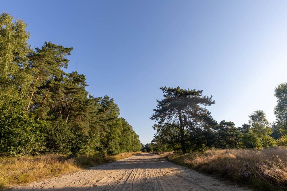
The reason for the line is geology. For long stretches the route follows the watershed on the geest, the sandy ridge of glacial deposits that forms the spine of the peninsula. Up there the rivers are still young and narrow and can be forded with ease. A few obstacles remained, notably the wide valley of the Vejle Å in Denmark and the Eider in the south. Unsurprisingly, these bottlenecks are where you find the most remarkable structures along the way.
One point matters for everything that follows: the road was never a single lane. When one set of ruts turned to mud, travellers simply moved over and made a new one. Over the centuries this produced broad bundles of parallel sunken tracks, which can still be traced in the landscape as shallow hollows. A "road" in this world was a corridor rather than a line.
The Danish name Hærvejen is usually translated as "army road", and hær does indeed mean "army". Danish scholars point out, though, that the word can also simply mean "crowd" or "host of people". A hærvej would then be a major public road, a road for the many, not necessarily a route for marching troops. In the 17th and 18th centuries Danes used the term quite generally for the bigger highways.
That this particular route became the Hærvej is largely down to the historian Hugo Matthiessen. In 1930 he published a book on the road along the Jutland watershed from Viborg to the Danevirke and fixed in the public mind the image of one continuous, immemorial highway. The book was hugely popular. So part of what feels ancient about Hærvejen is in fact a piece of 20th-century history writing.
The German name Ochsenweg, Low German Ossenpadd, refers to the great cattle drives that only shaped the route from the 15th century onward. Danish has matching names, Oksevejen and Studevejen (from stud, "ox, steer"). The regional name Sakservejen ("the Saxons' road") also turns up.
Long before anyone had a name for this road, people were moving across the dry uplands of Jutland. The clearest traces of that early traffic are Bronze Age burial mounds. Many of the best-preserved barrows in Jutland date to roughly 1400–1200 BC. Beneath them lay the dead in coffins made from hollowed oak trunks, some still with woollen clothing and bronze ornaments preserved.
What stands out is that these mounds often do not lie scattered at random but in long rows. The Danish Agency for Culture and Palaces describes such lines as indicators of old routes across the landscape. The logic is straightforward: if you buried your ancestors beside a busy track, everyone passing by saw them. A mound by the road was memorial, boundary marker and signpost in one.
It is worth being precise about the evidence. The mounds, their dates and their linear arrangement are archaeological fact. The tracks running between them are, for the Bronze Age, mostly inferred from the landscape rather than excavated. At the Danevirke, the archaeologist Frauke Witte also concluded that earlier routes there probably ran somewhat further west, again judging by Bronze Age barrows. The topography stayed the same; the actual ruts wandered.
In the late Viking Age the road suddenly comes into sharp focus, and it does so through royal power. Only a few kilometres from the line of Hærvejen lies Jelling, seat of Gorm the Old and his son Harald Bluetooth. Here stand the two great mounds, the church and the famous Jelling stones: Gorm's stone for Thyra and Harald's great runestone, on which he boasts that he won all of Denmark and Norway and made the Danes Christian.
South of Jelling, anyone travelling south had to cross the broad, wet valley of the Vejle Å. Right there, in the meadows of Ravning Enge, archaeologists found the remains of a huge timber bridge. It was about 760 metres long and at least 5 metres wide. It rested on some 280 trestles, or spans, each carried by four vertical oak posts and two raking braces. The posts measured around 30 by 30 centimetres, and the deck sat one to two metres above the water level of the time. The amount of oak that went into it was enormous.
So the often-quoted date of 979 is really the earliest possible date, not a precise construction year. Even so, the bridge very probably belongs to the reign of Harald Bluetooth. Its dead-straight, carefully planned layout recalls the geometric precision of the Trelleborg ring fortresses. And since it seems to have been in use for only a short time, many scholars also read it as a display of power by the king at Jelling.
Was the Ravning bridge part of Hærvejen? It certainly belonged to the network of routes leading south, and sunken tracks joined it at both ends. Whether every traveller used it, or whether people preferred to skirt the valley further west on the geest, we cannot say. Today you can walk the site, where reconstructions at either end mark its course.
At the southern edge of the old Danish kingdom the road meets the Danevirke, the great system of ramparts between the Schlei and the lowlands of the Treene and Eider. And here, for once, we have a written source from the Viking Age itself.
Under the year 808 the Royal Frankish Annals report that the Danish king Godofrid (Gudfred) came with his army to a harbour called Sliesthorp and decided to fortify the border of his realm towards Saxony with a rampart. According to the annals it ran from sea to sea and had only a single gate through which wagons and horsemen could be let out and admitted. The Latin reads: una tantum porta dimissa, per quam carra et equites emitti et recipi potuissent. For more on this royal seat and the question of where Sliesthorp lay, see our article on Sliasthorp and Füsing.
That gate is no longer just a phrase on parchment. Excavations in 2009 and 2010 close to the Danevirke Museum in the village of Dannewerk uncovered a passage roughly six metres wide through the fieldstone wall of the main rampart. Danish and German archaeologists continued the work together in the following years. The opening is interpreted as the gate later known in Danish sources as Kalegat and appearing in early medieval tradition as Wiglesdor, which can be rendered roughly as "warriors' gate". The name Kalegat itself is only recorded from the 16th century.
The finds in the gateway are wonderfully concrete: wheel ruts from the Viking Age and a plank roadway from the 13th century. According to Frauke Witte the passage was in use from the 6th to the 13th century and was built at the same time as the wall. Whether this is the very gate described for Godofrid cannot be proven. Its position on the line of the road and its long use, however, strongly suggest that this is where north–south traffic passed through the rampart.
Just to the east lay Hedeby (Haithabu) on the Haddebyer Noor, the great trading town of the Viking Age. Ships reached it from the Baltic via the Schlei, while the overland road connected it to the north and south. To the west lay Hollingstedt on the Treene, generally regarded as the North Sea harbour of Hedeby and later, above all, of Schleswig, some 15 to 20 kilometres away. The idea of a "land bridge between two seas", across which goods were transhipped to avoid the long voyage round the Skaw, is plausible and often told. How much cargo really took this route is not settled in detail, though, and Hollingstedt is better documented for the 11th and 12th centuries than for the early Viking Age.
Whoever held the gate held the road south, and the other side knew it. According to Thietmar of Merseburg, Emperor Otto II broke through the Danish defences in 974; within a few years the area was back in Danish hands. The story of the Danevirke and the road is one of barrier and passage at the same time.
A long-distance road links more than markets; it links people who need to meet. At the northern end of the classic route lies Viborg. Its name is usually explained as "holy hill", from Old Danish wi ("sanctuary") and bjerg ("hill"). That alone does not prove a pagan cult site. What is certain is that in the Middle Ages Viborg hosted the landsting of Jutland, the assembly for the whole region where kings were acclaimed and laws proclaimed. How such an assembly worked is explained in our article on the thing.
Further south, in Sønderjylland, the landsting of Urnehoved met on a ridge between Bolderslev and Uge south-west of Aabenraa, right next to the old north–south axis. Saxo Grammaticus reports that Harald Kesja was elected king there in 1134. In 1182 King Knud VI is said to have been acclaimed first at Viborg and then at Urnehoved, as if the king travelled down the road to be confirmed in each part of the land. The assembly is last mentioned in 1524. Its exact location has been debated since the 17th century, and the modern memorial site is not necessarily the historical spot.
Both pieces of evidence are high medieval rather than Viking Age, but they show how naturally assembly places sat on the great axis.
"Wits must he have who wanders wide, but all is easy at home."Hávamál 5, transl. Henry Adams Bellows, 1923
Most long-distance trade in the Viking Age moved by water. Ships were faster and carried far more than any cart. Yet the land route had its place, especially for whatever did not need or could not take a ship: livestock walking on its own legs, riders carrying messages, the retinues of kings and great farmers, and farmers heading to market or assembly.
Travellers used heavy wagons pulled by oxen or horses. The wheel ruts in the Danevirke gate fit neatly with the carra of the Frankish annals. For riders, about whom you can read more in our piece on Viking horses, the dry spine of the peninsula was ideal.
What they carried we can only infer from the trading sites: silver weighed out on scales (see our article on hacksilver), quernstones from the Rhineland, pottery, glass, furs, salt and, very probably, enslaved people. Which goods came overland and which via the Schlei can rarely be said in any individual case. For the bigger picture, see our article on Viking trade.
With Christianity came new travellers: pilgrims bound for Rome, Santiago and Jerusalem. Anyone from Norway or northern Jutland who wanted to go south by land took the old axis.
A wonderful witness is the Leiðarvísir, an Old Norse itinerary attributed to the Icelandic abbot Nikulás Bergsson and dated to the mid-12th century. It describes the route from Norway to Aalborg, then two days to Viborg and about a week from Viborg to Hedeby and Schleswig. From there it continues to the Eider, to Itzehoe and across the Elbe to Stade. That is, in essence, the line of Hærvejen.
Around 1500 the Nuremberg cartographer Erhard Etzlaub drew his famous "Rome Way" map for pilgrims, which also shows the route through Jutland. Today the Via Jutlandica, the Jutland section of the Way of St James, picks up this tradition and largely follows the Ox Road.
The name the road carries in Germany comes from an era long after the Vikings. From around 1420 a large share of Danish oxen were exported live to the south, at first in autumn drives. During the 15th century the numbers rose from about 2,000 to more than 10,000 animals a year. From around 1480 spring drives took over: the beasts were stall-fed through the winter and sent off in spring.
The business was lucrative enough for the crown to regulate it. In 1475 Christian I named Ribe, Kolding and Assens as trading places. From 1524 only the nobility, bishops and the king were allowed to fatten oxen on bought fodder, and in 1550 Christian III obliged peasants to stall-feed. What had been a sideline for farmers became the business of landlords and big merchants.
By the mid-16th century around 40,000 oxen a year passed the customs post at Gottorf near Schleswig, and the trade peaked in 1610–1620 at up to 45,000 animals a year. Autumn markets at Ribe and Kolding brought Jutland sellers together with German buyers. The main destination was the great cattle market at Wedel on the Elbe, which opened every year on 25 March and lasted three to four weeks. From there many animals went on to the Netherlands and the Rhineland. The marshlands of Schleswig-Holstein and Frisia also took cattle for fattening.
Then came the wars. The Emperor's War of 1625–1629 and the Swedish wars of 1643–1645 and 1658–1660 sent exports crashing. By the end of the 17th century they were back at around 20,000 oxen, and in the 18th century high Dutch import duties, among other things, squeezed the trade further. After 1800 the great overland export was largely over, and in the 19th century the railway took what was left.
There is an irony here: the very cattle drives that gave the road its name badly damaged its older traces. Thousands of hooves a year churned up the old ruts. That is one reason why it is so hard to read the exact Viking-Age course of the road from today's landscape.
Many structures now seen as typical Hærvej sights are younger than you might think. The famous stone Immervad Bro near Hovslund in Sønderjylland dates from 1786, and the granite-block bridge over the Gejlå from 1818. Before that, Danish bridges were built of timber. Most of the stone "Hærvej bridges" belong to the late 18th and 19th centuries. They are lovely all the same, and they show the road was still worth investing in well into the modern era.
In Schleswig-Holstein, between Sorgbrück and Kropperbusch near Rendsburg, you can find stretches still lined with earth banks and hedgerows. The road there is unsurfaced, paved only at a few difficult spots. One such stretch near Owschlag is protected as an archaeological monument. Walk it and you get a good sense of what an overland road felt like before turnpikes: sandy, wide and treacherous in the rain.
At the Danevirke you can visit the site of the gate by the Danevirke Museum; at Jelling the mounds, stones and church form a UNESCO World Heritage Site; at Ravning Enge a path runs between the reconstructed bridge ends. For more destinations see our guide to Viking museums and sites and to Viking traces in Germany.
In 1993 Denmark opened the waymarked Hærvejsruten as a cycling and walking route. The cycle route is now part of Danish National Cycle Route 3 and runs from Frederikshavn via Viborg to Padborg, about 420 kilometres. The hiking trail can start at either Hirtshals or Frederikshavn and is a little longer. In other words, today's Hærvej reaches well beyond the historical route from Viborg, far into the north.
On the German side, the Ochsenweg cycle route has existed since 1998, with two variants between the border near Flensburg and Wedel. It forms part of the German D-Route 7 and of EuroVelo 3. Because it runs along the geest ridge, it is pleasantly flat. The tourist route does not match the historical line everywhere: some old stretches can no longer be ridden, others have become main roads. At notable junctions, pairs of wooden horns recall the old route.
| Period | What is attested | Type of evidence |
|---|---|---|
| Bronze Age (c. 1400–1200 BC for many mounds) | Rows of barrows on the geest, probably along old routes | Archaeology; the track itself inferred |
| c. 808 | Godofrid's rampart with a single gate for wagons and riders | Contemporary Frankish annals |
| 6th–13th century | Passage through the Danevirke with Viking-Age wheel ruts | Excavation 2009/2010 |
| c. 980 or later | Bridge at Ravning Enge south of Jelling | Dendrochronology |
| Mid-12th century | Pilgrim route Aalborg–Viborg–Hedeby/Schleswig–Itzehoe–Stade | Leiðarvísir |
| 1134–1524 | Landsting at Urnehoved and Viborg | Medieval written sources |
| c. 1420 to c. 1800 | Cattle drives, peak 1610–1620 | Customs records, royal ordinances |
| 1930 | "Hærvejen" popularised as the name of the whole route | Hugo Matthiessen |
| 1993 / 1998 | Hærvejsruten and Ochsenweg cycle route | Modern route planning |
We at Glanz & Gravur love roads like this because they show history as a groove worn deeper by every generation. A Bronze Age farmer, a carter at the Danevirke gate, an Icelandic monk on his way to Rome and a 17th-century drover all walked the same spine of the peninsula. None of them would have called the road by the same name.

Where does the Ox Road (Hærvejen) run? The classic route runs from Viborg in Jutland via Vejle, Vejen and Aabenraa to the border at Padborg, then on past Flensburg, Schleswig and Rendsburg to Wedel on the Elbe. Beyond Rendsburg it splits into an eastern and a western branch.
Why is it called the Ox Road? The name recalls the great cattle drives that, from the 15th to the 17th century, took tens of thousands of oxen a year from Denmark to the south. For the Viking Age, "Ox Road" is a later umbrella term.
What does Hærvejen mean? Literally "army road". But Danish hær can also mean "crowd" or "multitude", so a hærvej was simply a major public road. As a name for the whole route, Hærvejen became popular mainly through Hugo Matthiessen's book of 1930.
Did the Vikings use the Ox Road? Yes, a forerunner of it. The gate in the Danevirke with Viking-Age wheel ruts and the Ravning Enge bridge of around 980 show that the north–south axis was in use and was developed by kings.
How old is the Ravning Enge bridge? The outermost ring in its dated oak posts is from 979, so the bridge was built in 979 at the earliest; a later reassessment places it between roughly 980 and 1010, probably under Harald Bluetooth.
Can you cycle Hærvejen today? Yes. In Denmark, Hærvejsruten (National Cycle Route 3) runs from Frederikshavn to Padborg, and since 1998 the Ochsenweg cycle route continues through Schleswig-Holstein to Wedel. The route along the geest is mostly flat.
For courage. For remembrance. For legends that live on.
Hedeby · The Danevirke · Reric · Hacksilver – silver as currency · Viking traces in Germany.
All Everyday Life & Craft articles →
There are tools that become legend. Among the Vikings it was a sword – or rather: a whole group of swords, all bearing …
Read more →The Viking ship was not merely a tool – it was a status symbol. And at its top there often gleamed a masterpiece of …
Read more →Matted hair, unwashed for years, reeking across the meadhall – that is the Viking of cliché. The finds tell another …
Read more →Coarse brown sacking, a shaggy fur collar, and of course the obligatory horned helmet – that is the Viking of film and …
Read more →