One people, one line, two rivers: that is all ancient literature has to say about the Pharodini. Around the middle of the 2nd century AD the Greek scholar Claudius Ptolemy placed them on the southern shore of the Baltic, east of the Saxons, between the rivers Chalusus and Suebus. No other ancient author knows the name. This article looks at what the source actually says, how to read its coordinates, which rivers might be meant, and why the Pharodini should be turned neither into the Varini nor into the owners of any particular cemetery.
We know little about many Germanic groups of the Roman Iron Age. About the Pharodini we know almost nothing. No leader, battle, sanctuary or inscription is known. What remains is an entry in a gazetteer compiled by a scholar in Alexandria in Egypt, some two and a half thousand kilometres from the Baltic as the crow flies. The entry says: after the Saxons, from the river Chalusus to the river Suebus, live the Pharodini.
The Pharodini sit in a chain of coastal peoples that runs from the Cimbric peninsula, that is Jutland, to the Vistula. Two links in that chain are well known: the Saxons in the west and, by way of a garbled name, the Rugians in the east. Two are attested only in Ptolemy: the Pharodini and their eastern neighbours, the Sidini.
A word on method first. I have not consulted a critical edition of the Greek text. I rely on an online version with the Greek and Latin text and the English translation by Edward Luther Stevenson (1932), from which I extracted the relevant sentences and coordinates. Anything that goes beyond that is flagged as such.
Claudius Ptolemy lived in Alexandria in the 2nd century AD. Besides his great astronomical work, the Almagest, he wrote the Geographike Hyphegesis, literally a "guide to drawing the map of the world". At its core it lists several thousand places, river mouths, capes and mountains with longitude and latitude, interspersed with short lists of peoples.
Ptolemy deals with Germania Magna, the free Germania beyond the Rhine and Danube, in his second book. In the Greek and Latin editions it is chapter 11 (headed "ΚΕΦ. ΙΑ´" and "CAP. XI" in the online version), whereas Stevenson's English translation counts it as chapter 10. So "II 10" and "II 11" in the literature refer to the same passage. Paragraph numbering within the chapter also varies between editions, so I give none here.
Ptolemy walks along the northern coast of Germania from west to east. After the North Sea peoples come the Saxons, who live "on the neck of the Cimbric peninsula", in the words of the Latin version: "per cervicem Cimbricae Chersonesi Saxones". Then follows the sentence that matters here:
"… after the Saxons from the Chalusus river to the Suevian river the Farodini … then the Sidini up to the Viadua river … and after these the Rugiclei up to the Vistula river."
Claudius Ptolemy, Geographike Hyphegesis II 11 (II 10 in Stevenson's numbering); English translation by Edward Luther Stevenson, Geography of Claudius Ptolemy, New York 1932, excerpts from Bill Thayer's online transcription.
That is all Ptolemy says about the Pharodini on the coast: no size, no language, no place of their own, no history. The Pharodini are a stretch of coast with a name attached, bounded by two river mouths whose coordinates he lists elsewhere in the chapter.
A little more emerges from the list of inland peoples. There Ptolemy places groups "between" the coastal peoples and the Suebi further south. The Latin version reads "inter Saxones et Suevos Teutonoari atque Viruni" and "inter Pharodinos et Suevos Teutones atque Avarni": between the Saxons and the Suebi the Teutonoari and Viruni, between the Pharodini and the Suebi the Teutones and Avarni. Here the Pharodini serve as a reference point for the hinterland.
Stevenson's translation is regarded as flawed; Bill Thayer, who transcribed it, points serious readers to Karl Müller's edition of 1883. For a list sentence made up of names and prepositions this hardly matters.
In the Greek text the people are called Φαροδεινοί, transliterated Pharodeinoi. Latin editions write Pharodini, Stevenson writes Farodini. The German form "Pharodiner" is a modern adaptation, as is usual for tribal names known only from antiquity.
I know of no secure interpretation of the name. Splitting it into Germanic-sounding elements would be speculation, since we do not know how it sounded before passing through several languages and copies. A Greek writer heard or read a foreign name, probably already in Latin form, and rendered it in Greek letters. The initial Ph may stand for a sound a Germanic speaker would have pronounced differently. The ending -einoi is a Greek ending for names of peoples.
One small detail stands out: the neighbouring name Sideinoi also ends in -deinoi or -einoi. Whether that points to a shared source for this stretch of coast, to the habit of one editor, or to chance cannot be decided.
Then there is the history of the text. The Geography does not survive in Ptolemy's own copy, only in medieval Byzantine manuscripts, according to the usual account from around 1300 onwards; I have not rechecked this for this article. Rare names that no copyist could check against his own knowledge are especially prone to error.
Ptolemy never saw the Baltic, let alone surveyed it. His Geography is desk work that collects existing material, sorts it and converts it into coordinates. In his first book he explains that he builds on the work of a predecessor, Marinus of Tyre, whose figures he criticises and corrects in many places. Marinus in turn used travel reports, distances along roads and coasts, and accounts from sailors and traders, as far as we can tell.
For the Baltic coast the chain might have looked roughly like this. A traveller learns what the people on a stretch of coast are called and how many days it takes to sail from one river mouth to the next. The report is written down, translated, combined with others, and finally converted into stades and degrees. Each step can alter names and distort distances.
When the information about the Pharodini was gathered, we do not know. Ptolemy wrote around the middle of the 2nd century, and his sources may be decades older. So it is not even certain that a group of that name still existed in his day. We can only say when their name was written down.
Among the well-known weaknesses of the work is that Ptolemy reckoned with too small a circumference of the earth. Distances given in stades therefore produced degree spans that were too large. Data from sources with different reference points also had to be stitched together, so the pieces of his Germania do not fit neatly. There is also the risk of duplicates, when the same people appeared under different names in two reports. Conversely, some peoples that other authors place on the Baltic are missing, such as the Lemovii of Tacitus.
Because Ptolemy gives a longitude and latitude for every river mouth, the coastal sections can at least be compared within his own system. The online version gives these values for the mouths along the Baltic coast (longitude counted from a prime meridian at the "Islands of the Blessed" in the far west, usually taken to be the Canaries; latitude in degrees and minutes):
In Ptolemy the Elbe mouth lies on the North Sea and the others on the Baltic; in between, his coastal description goes round the Cimbric peninsula. The Pharodini section from the Chalusus to the Suebus spans two and a half degrees of longitude in his system. The Sidini section to the Viadua spans three, the Rugiclei section to the Vistula again two and a half. All the Baltic mouths sit on the same latitude of 56 degrees. Ptolemy evidently treated this coast as a straight west-east line.
These figures allow a simple experiment, which I flag explicitly as my own rough example and not as a research result. Suppose the Suebus is the Oder (more precisely its outlet around the Swina) and the Vistula is the Vistula. Then Ptolemy's five and a half degrees between them correspond to about four and a half degrees on a modern map. Applying that ratio to the Pharodini section takes you a little over two degrees of longitude west of the Szczecin Lagoon, roughly to the mouth of the Warnow near Rostock. The same procedure puts the Viadua near the Wieprza in Farther Pomerania, now in Poland, which fits a proposal by the Berlin research group mentioned in our article on the Sidini.
The experiment assumes that Ptolemy's distortion is even along this coast, which is far from certain, presupposes that the Suebus is the Oder, and treats as precise figures that rest on travel times and copying. All it shows is that Ptolemy's numbers are compatible with placing the Pharodini on the coast of Mecklenburg and Western Pomerania. It cannot prove that location.
One place deserves mention. Among the towns Ptolemy lists for this part of Germania is one called Alisus, at longitude 38° and latitude 55°. In his system that lies between the Chalusus and the Suebus, one degree inland from the coast. But Ptolemy does not assign towns to peoples, and I have not checked which modern place might be meant.
Everything that can be said about where the Pharodini lived depends on two river names that occur only in Ptolemy. Neither is in use today, and no other ancient source supports any identification.
For the Suebus, the Oder is now the most widespread interpretation. The name is clearly linked to the Suebi; Ptolemy himself has the Suebic Semnones reach "as far as the river Suebus", as the Latin version puts it ("usque ad Suevum fluvium"). Older proposals also looked for the Suebus among smaller coastal rivers such as the Warnow or the Peene. I have not traced the origins of these older identifications for this article; they are mentioned in overviews without my having seen the arguments.
For the Chalusus, proposals range across the area between Holstein and Western Pomerania. The ones mentioned most often are the Trave and the Warnow; other coastal rivers such as the Recknitz are occasionally brought into play, although I could not check a source for that. The article on the Varini on this site names the Trave and the Warnow as common identifications. The available sources do not allow a decision. The Trave would give a long Pharodini section, the Warnow or Recknitz a shorter one further east.
The consequences for the Pharodini are limited but important. If the Suebus is the Oder, they lived on the coast of Mecklenburg and Western Pomerania, roughly between the Bay of Lübeck or the Rostock area and the Szczecin Lagoon. If the Suebus is a smaller river further west, their section shrinks accordingly. Either way it belongs to the southern Baltic coast between Holstein and the Oder; more precision is not possible.
The list of inland peoples uses the Pharodini as a point of reference. Between them and the Suebi Ptolemy places the "Teutones" and the "Avarni". Further west, between the Saxons and the Suebi, come the "Teutonoari" and the "Viruni". By Suebi Ptolemy here means groups he places further south, among them the Suebic Angles, whom he extends east of the Langobards as far as the middle Elbe, and the Semnones, who reach the Suebus.
The Teutones in this context are a puzzle of their own. The name recalls the Teutones who marched against Rome together with the Cimbri around 100 BC (see Cimbri and Teutones). Whether Ptolemy means a remnant group or took an old name from a literary source cannot be read from his text.
For the Avarni the tradition wavers. The Latin version I saw has "Avarni"; other accounts give the name as Auarpoi or Avarpi. This variation matters directly for the Pharodini, as the next section shows.
It is tempting to link a name attested only once with a better-known one. For the Pharodini the obvious candidate is the Varini. In his Germania (around AD 98, chapter 40) Tacitus names a group of peoples who jointly worshipped the goddess Nerthus: the Reudigni, Aviones, Angles, Varini, Eudoses, Suardones and Nuitones. Scholars often look for the Varini in western Mecklenburg, partly because of names such as Warnow, Warin and Waren, although their connection with the tribal name is disputed.
Where the Varini appear in Ptolemy is itself an open question. Our article on the Varini gives the Viruni (Greek Ouirounoi), placed by Ptolemy between the Saxons and the Suebi, as the most common reading. Others see the Avarni as a form of the same name, which only works if one follows the reading "Avarni" rather than "Auarpoi". In an online summary on the Avarpi I also found the claim that Ptolemy calls the Varini Farodeinoi, that is Pharodini. The claim is explicitly marked there as lacking a citation, and I have not seen a scholarly publication that argues for it.
Several points speak against a simple equation of Pharodini and Varini. First, Ptolemy himself has names in the same chapter that sound closer to the Varini, namely Viruni and, depending on the reading, Avarni. If he already lists the Varini under one of those names, a third form on the coast is less likely, though not impossible given the risk of duplicates. Second, the sound gap between Pharodeinoi and Varini is considerable; one would have to assume several copying errors. Third, both locations are vague, so their overlap in Mecklenburg proves little.
Essentially only geography speaks for a link: Ptolemy puts the Pharodini roughly where other considerations place the Varini. That is a hint, not evidence. Calling them "Ptolemy's Varini" turns a thesis into a fact.
Nor does Ptolemy say that the Pharodini spoke a Germanic language; for him "Germania" is a geographical term. Scholars assume Germanic speech on the southern Baltic coast for other reasons, such as the neighbouring names and Tacitus's reports. Anyone who wants to place the Pharodini in a family tree can at most put them provisionally among the West Germanic groups of the Baltic region, with the note: assignment uncertain.
Archaeology cannot find the Pharodini, because finds do not carry tribal names. A pottery style or a burial custom shows how people lived, not what a geographer in Alexandria called them.
What archaeology can show is the setting. Mecklenburg and Western Pomerania were settled in the Roman Iron Age, and the region has produced graves with Roman imports, objects from the Empire that reached the north through trade, gifts or military service. One example often mentioned in this connection is a richly furnished grave near Hagenow in south-western Mecklenburg. I have not checked the date and contents of this find against the specialist literature, so I do not give them here. Hagenow also lies inland, west of Schwerin, and thus not on the stretch of coast Ptolemy describes.
The so-called princely graves of the Lübsow type, named after a site in today's West Pomerania in Poland (Lubieszewo), are interpreted in the literature as graves of an elite with links to the Roman Empire. Lübsow itself lies east of the Oder and so, if the Suebus is the Oder, outside the Pharodini section. Such graves attest elites with long-distance contacts, not a tribe.
Speaking of "Pharodini finds" or "Pharodini princes" would therefore be dishonest. In the literature I have seen for this article I have not come across any attribution of a site to the Pharodini.
In 2010 Andreas Kleineberg, Christian Marx, Eberhard Knobloch and Dieter Lelgemann published "Germania und die Insel Thule. Die Entschlüsselung von Ptolemaios' 'Atlas der Oikumene'". The group tried to remove the distortions in Ptolemy's coordinates using surveying methods. Their approach: the map breaks down into sections, each shifted and stretched in its own way. Calculate out the distortion for each section, and the ancient places should be assignable to modern ones.
Our article on the Sidini mentions, for example, their proposal to identify the Viadua with the Wieprza. Which identifications the group proposes for the Chalusus and the Suebus I have not been able to read in the publication itself, so I give none.
Criticism of the method focuses on several points that can be followed even without knowing the individual reviews. Ptolemy's figures are the end product of a long chain of travel reports, conversions and copies. Errors in that chain are not evenly distributed but random: a miscopied numeral shifts a single place without that being inferable from the distortion of its surroundings. And a corrected coordinate usually yields an area with several possible sites; choosing one is a further decision the calculation does not make. I have not read the individual reviews for this article; these are the core methodological questions any such identification must answer.
For the Pharodini the project changes little. Even the most precise correction would only confirm the stretch of coast where Ptolemy placed them. Who lived there and what those people called themselves, no coordinate calculation can answer.
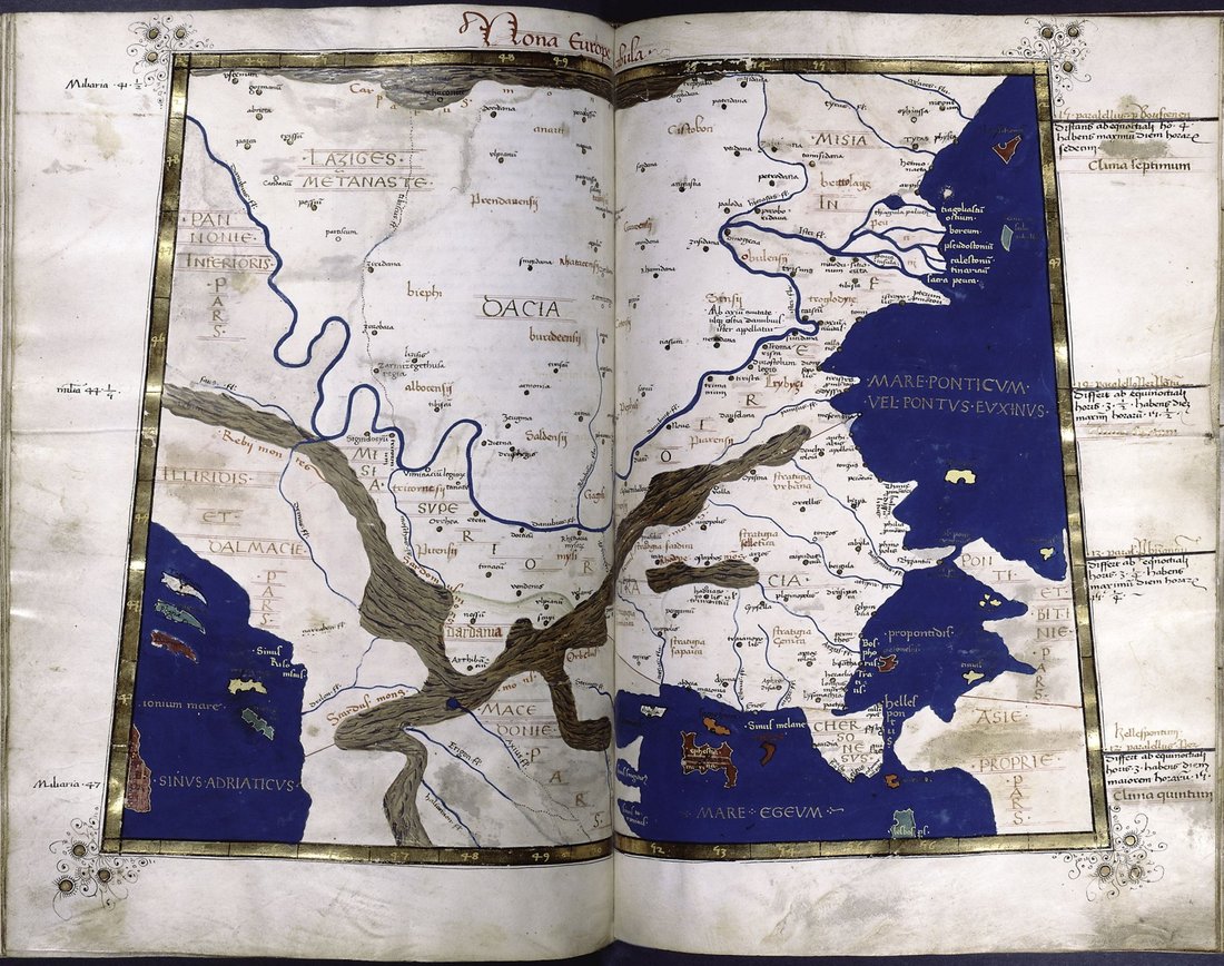
After Ptolemy the name disappears. No later author known to me takes it up. It survives only where the Geography itself survived: in the Byzantine manuscripts, in the Latin translations of the 15th century and in the printed Ptolemy maps of the Renaissance, which show Germania with its coastal peoples.
In modern times the Pharodini became an entry in handbooks and on historical maps. Such maps show the reconstruction of an ancient ordering system, not a settlement boundary. A line on a modern map enclosing the "territory of the Pharodini" is always an interpretation.
Who were the Pharodini? A group named only by Claudius Ptolemy around the middle of the 2nd century. He places them on the southern Baltic coast east of the Saxons. No source says anything about their language, way of life or history.
Where did the Pharodini live? Between the rivers Chalusus and Suebus. The Suebus is usually taken to be the Oder and the Chalusus the Trave or Warnow, which would put their stretch of coast in Mecklenburg and Western Pomerania. That is not certain.
Were the Pharodini the same as the Varini? That is an unproven thesis. Ptolemy probably uses other name forms for the Varini, and the sound gap is large.
Are there archaeological finds of the Pharodini? Not in the sense of finds that carry a name. There are Roman Iron Age finds from Mecklenburg and Western Pomerania, but they cannot be assigned to a particular tribe.
What does the name mean? I know of no secure interpretation. The name passed through several languages and copies, and its original form cannot be reconstructed with confidence.
The Sidini · The Saxons · The Warni · The Rugii · The Suebi.
All History & Finds articles →
The Pictones lived in western Gaul between the Loire and the Atlantic, in what became Poitou. Caesar names them in 56 …
Read more →The Polabians, Slavs "on the Elbe", settled from the early Middle Ages in what is now Lower Saxony, Mecklenburg and …
Read more →The Polans lived on the middle Dnieper, in the land around later Kyiv, and almost everything we know about them comes …
Read more →